The Meltemi is a strong, dry northerly wind that sweeps the Aegean Sea from roughly mid-May through mid-September, peaking hard in July and August. It can hand sailors days of perfect, breezy conditions, then turn without much warning into gusts that cancel ferries and pin boats to harbor. If you’re planning a summer sailing trip in Greece, this is the one weather pattern you plan your whole itinerary around.
En bref :
- The Meltemi is most intense in July and August, with gusts exceeding 100 km/h and Beaufort 9 occurrences, especially in the northern Aegean.
- In strong wind episodes, the Meltemi produces short, steep waves that often cause ferry cancellations and create choppy, uncomfortable conditions for small boats.
- Planning for sailing or ferry travel should prioritize early morning departures, sheltered anchorages, and routing around narrow channels during peak wind hours.
- Forecasts from the Greek meteorological service and visual signs like cloud patterns and barometer changes are crucial for anticipating the wind’s arrival and strength.
- Experienced local skippers understand regional wind behaviors and are better positioned to plan safe routes and shelter options during the Meltemi season.
Table des matières
- What Causes the Meltemi Wind in Greece?
- When and Where the Meltemi Blows Strongest
- How Strong the Meltemi Wind Actually Gets
- How the Meltemi Disrupts Ferries, Beaches, and Travel Plans
- Sailing and Travel Planning for Meltemi Season
- Why Wind Conditions Vary So Much Between Islands
- Spotting an Incoming Meltemi Before It Hits
- Our Take: Planning Around the Meltemi, Not Around the Calendar
- Sail Meltemi Season With Local Skipper Knowledge on Your Side
- Where to Verify Meltemi Conditions Before You Sail
- Sources
- FAQ
What Causes the Meltemi Wind in Greece?
The Meltemi forms from a straightforward pressure battle. High pressure sits over the Balkans and Central Europe through the summer, while a low pressure trough builds over Anatolia and the interior of Turkey as the land heats up. Air rushes from the cooler, higher pressure zone toward the heat, and the Aegean funnels that rush of northerly air right through its islands. The result is a dry, often cloudless wind that can feel refreshing even as it kicks up a nasty sea.
Meteorologists call this pattern the etesian winds, a name that comes from the Greek word etos, meaning “year,” a nod to how reliably this wind returns every summer. The word “meltemi” itself likely traces back to the Italian phrase mal tempo, or “bad weather,” a fitting bit of irony given how many Greek summer days it actually salvages rather than ruins.
The Meltemi isn’t just a local Aegean quirk. Research into etesian wind behavior links the strongest episodes, sometimes called “outbursts,” to interactions between the Subtropical and Polar Jet Streams overhead. When those larger circulation features line up, the Meltemi can blow hard for several days straight without the usual overnight calm, a pattern documented in atmospheric research on etesian wind outbursts over the Greek seas. That’s the version of the Meltemi that catches unprepared sailors off guard: not a single windy afternoon, but a multi-day system that behaves more like a front than a daily sea breeze.
When and Where the Meltemi Blows Strongest
Meltemi season runs from about mid-May to mid-September, with the wind at its most frequent and intense during July and August. Outside that window, the Aegean settles into calmer, more variable conditions, which is part of why late spring and early fall have become popular for sailors who want warm water without the wind lottery.
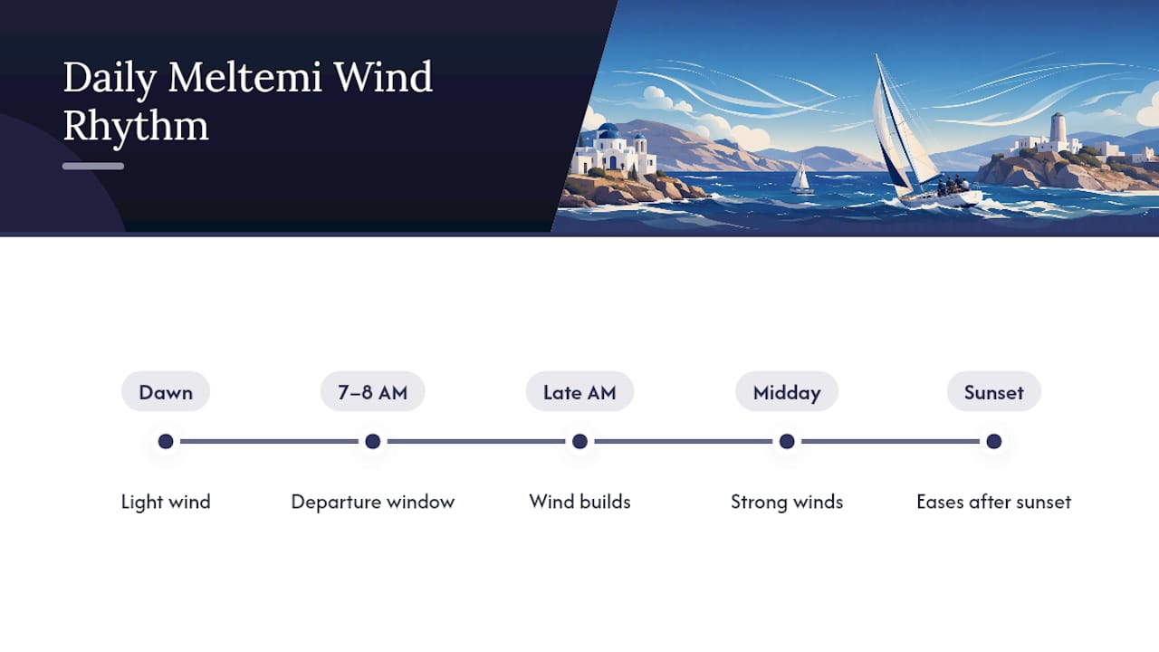
Within a Meltemi day, there’s a rhythm worth building your schedule around. The wind typically stays light through early morning, builds through late morning into early afternoon, holds strong through the heat of the day, then eases noticeably after sunset. Skippers who know this pattern well tend to plan early-morning departures, often between 7:00 and 8:00 AM, to cover open-water legs before the afternoon wind machine switches on.
Geography changes the story island by island. The northern Aegean, including the approaches around the Sporades and the Thracian Sea, tends to catch the wind at its rawest since there’s less land to slow it down before it arrives. The Cyclades sit squarely in the wind’s main corridor, and island-hopping here in July or August almost always means factoring the Meltemi into your daily plan rather than treating it as an occasional surprise. Head further south toward Crete and the southern Aegean, and the wind often loses some of its bite, partly because it has more distance and more islands to filter through before it gets there.
For anyone booking ferries or charter dates, this regional variation matters more than the calendar alone. A late-August passage through the Cyclades and a late-August passage around Crete can feel like two entirely different summers.
How Strong the Meltemi Wind Actually Gets
Most Meltemi days typically exhibit winds in the fresh to strong breeze range on the Beaufort scale, with stronger episodes sometimes reaching higher levels, and gusts often exceeding the sustained wind speed.
That gap between sustained wind and gust strength is exactly why marine forecasts flag gusts separately. Port authorities and forecasters warn that individual gusts, and individual waves, can run well above the reported average, which is why a forecast reading “strong breeze” can still produce moments that feel like a full gale.
2026 season in numbers: Greece logged 16 strong-wind days over summer 2026, with gusts hitting Beaufort 9 on three separate occasions. Some island locations recorded gusts exceeding 100 km/h in August 2026, a reminder that even a “typical” Meltemi season carries real teeth.
Those numbers matter for anyone reading a forecast and assuming Beaufort 6 means a pleasant sail. It might, right up until a channel between two islands compresses that same wind into something considerably stronger. Read every Meltemi forecast a little conservatively, and build in a buffer before deciding a passage is safe.
How the Meltemi Disrupts Ferries, Beaches, and Travel Plans
Wind speed alone doesn’t tell the whole story. What actually disrupts a trip is what the Meltemi does to the sea and the coastline around it.
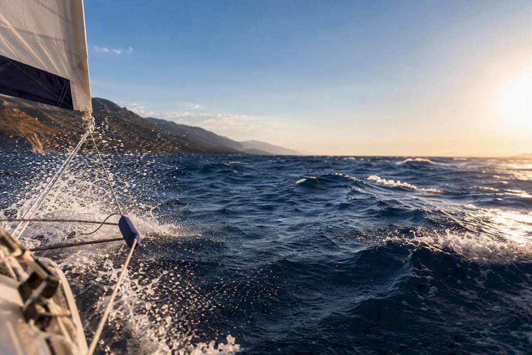
Sustained Meltemi winds build short, steep waves rather than long rolling swells, because the fetch across the Aegean is relatively short and the wind is blowing against a sea that’s often still adjusting from the night before. That produces confused, choppy conditions that are far more uncomfortable for small craft than the same wind speed would be on open ocean. It’s the difference between a smooth ride and a boat slamming through wave after wave.
Ferries feel this acutely. A vessel large enough to handle the open-water crossing safely can still be barred from docking if a harbor’s approach is too exposed or too narrow, which is why Meltemi season regularly produces ferry cancellations even on routes that look calm from shore. The boat isn’t necessarily unsafe at sea. The port simply can’t be approached safely in the crosswind.
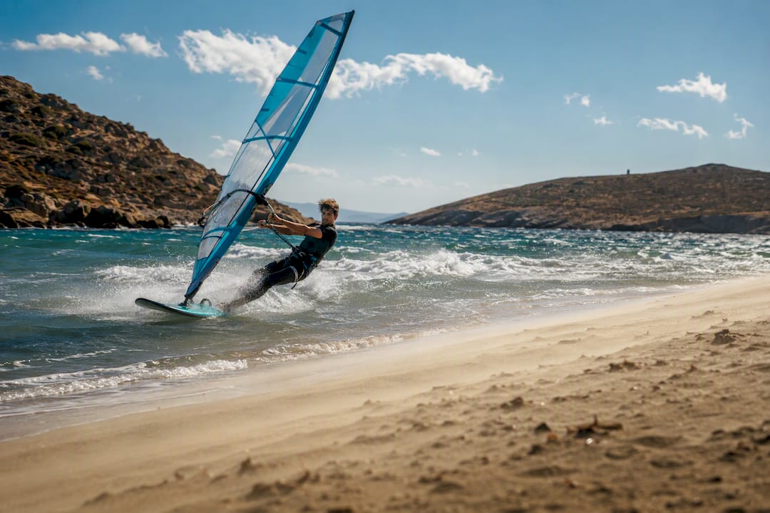
On land, exposed beaches on the northern or western shores of Cycladic islands, the sides that face the wind directly, often turn unpleasant fast, with blowing sand and surf that makes swimming genuinely risky rather than just annoying. Sheltered, leeward beaches on the same island can be flat calm at the same hour. Windsurfers and kitesurfers chase the Meltemi on purpose. Families looking for a lazy beach day need to check which side of the island they’re headed to before they pack the cooler.
Sailing and Travel Planning for Meltemi Season
Planning around the Meltemi isn’t about avoiding it. It’s about working with its rhythm instead of fighting it.
- Pick your dates with the wind in mind. If your group wants steadier, more forgiving conditions, aim for late May, early June, or September. If you want the Meltemi’s reliable afternoon breeze for actual sailing, July and August deliver it, just with more planning required.
- Check the morning forecast, every morning. Don’t rely on a forecast from two days ago. Confirm ferry schedules and marine warnings before you commit to a route for the day.
- Schedule open crossings early. Aim to be underway on longer legs by 7:00 or 8:00 AM, well before the wind typically builds toward its early-afternoon peak.
- Choose leeward anchorages. Study the chart for coves and harbors sheltered from the north and northwest before you set out, not after the wind picks up.
- Avoid narrow, exposed channels during peak hours. Straits between islands often accelerate the wind well beyond the open-water forecast. Cross them early or route around them.
- Reef early and secure loose gear. If there’s any doubt about the afternoon forecast, reduce sail before it’s uncomfortable to do so, and brief your crew on where the safety gear lives.
- Build a decision rule into the day. Agree in advance on what wind strength or wave state means you postpone, reroute, or return to shelter, so nobody’s making that call emotionally in the middle of a bad crossing.
Conseil de pro : Treat any afternoon Meltemi forecast above Beaufort 6 as your cutoff for open-water legs. It’s far easier to enjoy a long lunch in a sheltered harbor and sail at dawn than to fight a building sea in the heat of the day.
A skipper-led itinerary through the Cyclades already builds most of this thinking into the day-by-day plan, which takes the guesswork out of it for anyone who’d rather spend the crossing enjoying the ride than watching the barometer.
Why Wind Conditions Vary So Much Between Islands
The Aegean’s geography turns one wind direction into dozens of local personalities. Wind squeezed between two hills or through a narrow strait accelerates, sometimes dramatically, in what sailors call a jet effect, producing bands of much stronger wind than the open water just a mile away.
Leeward pockets do the opposite. A cove tucked behind a headland on the wind’s downwind side can sit almost flat calm while the channel outside is churning at Beaufort 6 or 7. Recognizing this pattern is a big part of surviving Meltemi winds comfortably rather than just enduring them.
- The Cyclades see some of the sharpest contrasts, with channels between islands like Paros and Naxos known for local acceleration.
- Larger islands with high interior terrain, such as Naxos and Tinos, create pronounced wind shadows on their southern and eastern coasts.
- The Dodecanese and southern Aegean generally see gentler contrasts, since the Meltemi arrives already weakened by distance.
- Pilot charts and pilot books remain the most reliable way to spot these local effects before you’re caught inside one.
Spotting an Incoming Meltemi Before It Hits
Reliable forecasts come first. The National Observatory of Athens and Greece’s national meteorological service issue marine forecasts that separate sustained wind from gusts, which matters far more in the Aegean than a generic weather app’s single wind number ever will.
Beyond the forecast, the sky often tips its hand:
- Scattered altocumulus clouds or lens-shaped orographic clouds forming on the leeward side of islands often signal building pressure gradients.
- A noticeable drop in humidity paired with a rising barometer frequently precedes a Meltemi onset by several hours.
- Multi-day “outburst” episodes, tied to jet-stream interactions rather than daily heating, tend to arrive without the usual evening lull, so a Meltemi that doesn’t ease after sunset is a sign you’re in one.
Treat those visual cues as a backup, not a replacement, for checking an actual marine forecast before you leave the dock.
Our Take: Planning Around the Meltemi, Not Around the Calendar
Most guidance treats the Meltemi as something to avoid, as if the smart move is booking outside of July and August altogether. We think that undersells what the wind actually offers. A well-timed Meltemi afternoon is some of the best sailing in the Mediterranean: steady, predictable breeze, warm water, and enough wind to actually feel the boat move.
The mistake isn’t sailing in Meltemi season. It’s sailing in it without a plan that respects how the wind behaves hour by hour and island by island. That’s why we build routing around the morning window, choose anchorages with the afternoon wind already in mind, and lean on skippers who know exactly which channel between which two islands turns nasty at 2:00 PM on a Tuesday in August. A bareboat charter with a paper chart and a general sense of “north wind coming” isn’t the same as local knowledge that’s watched this exact pattern play out for years.
- Voile
Sail Meltemi Season With Local Skipper Knowledge on Your Side
A forecast tells you the wind is coming. A skipper who’s sailed these exact channels for years tells you which cove to duck into before it arrives. That’s the practical difference a good local charter brings to a Greek summer holiday: skippered options built by people who plan routes around the Meltemi’s daily rhythm instead of hoping it stays quiet.
Notre Greece sailing destinations cover the Cyclades and beyond with itineraries designed to put you in sheltered water by early afternoon and back on deck for sunset. If you’d rather have a local skipper reading the wind than reading it yourself, our private sailing charters pair your group with someone who already knows which anchorages hold up when the Meltemi builds. Flying into Athens on a flexible schedule to match a Meltemi-friendly window? A private charter transfer can line up your arrival with your boarding date instead of the other way around. Check available dates and request Meltemi-aware routing for your group before the July and August calendar fills in.
Where to Verify Meltemi Conditions Before You Sail
For up-to-date marine forecasts, consult the National Observatory of Athens’ etesian wind data. For a closer look at how local topography shapes wind behavior island by island, the World of Europe’s Meltemi report breaks down channel and lee effects in detail. Recent season figures come from Parapolitika’s 2026 Meltemi wind day count.
Sources
- Greece’s Meltemi winds this summer: 16 strong wind days explained
- The Meltemi explained: The wind that shapes summer in the Aegean
- Etesian winds outbursts over the Greek Seas and their linkage with larger-scale atmospheric circulation features
- Meltemi
- Etesian winds
FAQ
How Strong Are the Meltemi Winds in Greece?
Most Meltemi days run 5 to 7 on the Beaufort scale, with stronger episodes reaching 8 or higher. Summer 2026 included occasions with gusts reaching Beaufort 9, and some locations recorded gusts over 100 km/h in August.
What Are Meltemi Winds?
The Meltemi is a dry, seasonal north-to-northwesterly wind that blows across the Aegean Sea from about mid-May to mid-September, driven by high pressure over the Balkans meeting a summer heat trough over Anatolia.
Why Is It So Windy in Greece Right Now?
If it’s July or August, you’re likely in the heart of Meltemi season, when the pressure difference between the Balkans and Anatolia is at its strongest and the wind typically builds through the afternoon before easing after sunset.
Which Place in Greece Is the Windiest?
The Cyclades and the northern Aegean generally see the strongest and most frequent Meltemi winds, while islands further south toward Crete tend to experience a noticeably weaker version of the same wind by the time it arrives.
Recommandé
- Skipper a testé l'itinéraire de navigation dans les Cyclades avec des programmes prêts jour par jour
- Itinéraires de navigation de 7 à 10 jours dans le Dodécanèse pour des équipages de niveaux mixtes
- Itinéraire de navigation de 7 jours en famille aux Sporades, 130–155 milles nautiques, testé par un skipper
- Vacances en voilier avec skipper en Grèce pour les familles